|
Marco Island Florida - Self-Guided Quicktour
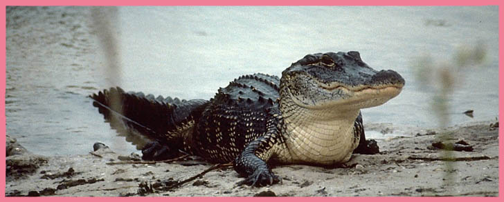
"The 6,800-acre Marco Island is the largest of the 10,000 Islands. It is surprisingly diverse and includeshigh sandhills, slash pine forests, and sandy fields, in addition to quartz sand beaches and mangrove swamp. It is the only place in the 10,000 Islands to see burrowing owls"....
by Jeff Ripple, author, Day Paddling - Florida's 10,000 Islands and Big Cypress Swamp
A self-guided historical tour of Marco Island is marked with 13 bronze plaque markers and are easy to follow using the map below:
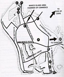
Marker #1
(located on west side at foot of S.S. Jolley Bridge)
Marco Island
5000 B.C.-1994
Evolution of largest of Ten Thousand Islands
Marker #2
(old Marco Village)
Marco Village: 1870
Ferry Landing: 1912-1938
Site of development of Olde Marco
Markers 2 and 3 are in Olde Marco adjacent to the Villa de Marco boat ramp
Marker #3
Marco Village School
Site of First School
Marker #4
(Bald Eagle Dr., west side in front of Marco Vista)
Captain William D. Collier Homesite
Circa 1880
 Marker #5
(Bald Eagle Dr., west side in front of Marco Vista)
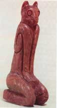
Frank Cushing Archaeological Site
Site of one of the most significant excavations in North America-"MarcoCat" found here
Marker#6
(Bald Eagle Dr., west side beyond Elckam Circle, and adjacent to entrance road to cemetery)
Marco Island Cemetery
Circa 1880
Old Cemetery which is still in use
Marker #7
(From Bald Eagle Dr., turn left on Bayport to 5th right , which is Society Ct.)
Railroad Turn-A-Round
1927-1944
Site of depot of Atlantic Coast Line Railroad
Marker#8
(On Inlet Drive between Travida and Olds Ct.)
Caxambas Cemetery
Circa 1890
Site of cemetery used by early Caxambas settlers
Marker #9
(Olds Ct., north side on Inlet Dr., take 1st left after Caxambas Cemetery Marker)
Kirk Archaeological Site
Calusa Indian burial mound
Marker #10
(Inlet Dr., south side after Osceola Ct., Inlet turns to west)
Burnham Clam Factory
1904-1929
Site of original clam factory
Marker #11
(Scott Dr., and Indian Hill Rd.)
Indian Hill-Barfield Homesite
Highest elevation in SW Florida and homesite of Tommie Barfield
Caxambas School
1890-1928
Site of early school
Marker #12
(South Barfield Dr., northbound across from Wesley United Church)
Pineapple Plantation
1901-1906
Site of early agricultural venture
Marker #13
(Goodland Rd. off S.R. 92 east near painted water tank)
Goodland Village and Access Road
Village built on Calusa shell mound
|